Integrated report 2019
Exxaro Resources Limited
Consolidated Mineral Resources and Mineral Reserves Report
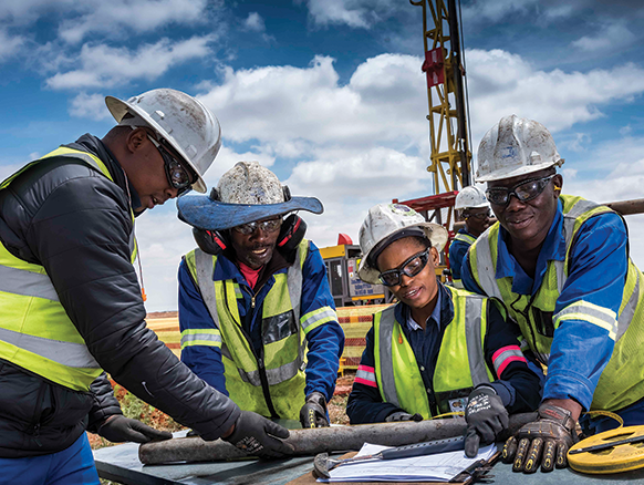
Exploration in existing operations of our coal business consisted primarily of drilling (diamond core and reverse circulation) with surface geophysical surveys, when required, and downhole geophysical logging.
In 2019, a number of initiatives were implemented to utilise technology to enhance our exploration activities. In 2018, we indicated that the centralised managed acQuire database system was successfully implemented. Initially some challenges regarding the information management support systems were experienced but this was overcome and the bulk of borehole data captured during the reporting year was successfully deposited directly into the cloud-based database. This initiative not only increase the ease and speed of core logging-and-sampling but also improve data integrity and security vital to our Resource estimation assurance process. In addition the implementation of the EQuIS groundwater data system ensure real-time groundwater data capture for fast and effective decision making regarding water management as well as empowering us in taking proactive steps to ensure compliance to our water use licence requirements.
All exploration holes, aligned with our Exploration Procedure must be downhole geophysically logged using density and gamma probes for validating borehole depths and geological contacts. In 2019, we also started surveying selective holes using optical televiewer (OTV), acoustic televiewer (ATV) and Sonic to obtain geotechnical information of the rock mass. Geotechnical data collection from exploration boreholes are historically limited due to a number of factors, including the requirement that the complete coal zones be sampled for coal quality tests. This requires that dedicated boreholes be drilled only for geotechnical sampling and testing resulting in a significant increase in exploration cost. Geophysical down-hole logging using the abovementioned techniques allowed us to conduct repeatable measuring of the physical properties of the undisturbed rock mass down the borehole wall. Empirical methods were then applied to the data to obtain the required geotechnical parameters. Advantages of applying these techniques include non-destructive, quick, precise, repeatable, and continuous surveying along the depth of the borehole (including weak zones). The successful implementation of these technologies will ensure that in future all boreholes targeting the Coal Resource as well as geological structures can be surveyed and used as points of observation for geotechnical interpretations.
Exploration in 2019 was primarily conducted to improve geological confidence to enhance geological modelling and estimation. These boreholes are depicted in the relevant locality maps in the ancillary section. A limited amount of geotechnical and hydrogeological drilling was conducted to improve mine-planning parameters and is included in exploration results (Table 78).
No exploration was conducted on areas not included in the Coal Resource statement. The exploration cost reflected at Thabametsi and the Waterberg North and South project areas are related to the reworking of exploration data to identify information gaps to plan future exploration activities as well as for the compilation of reports associated with legal reporting and mineral right closure.
The Coal Resource in the various operations were reviewed in 2019 to identify and outline geological challenges. Based on this review, an integrated exploration plan was compiled that includes activities required to address Coal Resource and metallurgical characterisation, overburden characterisation, geological structure as well as rock engineering and hydrogeological data requirements. The plan is dynamic and additional activities are included when previously unforeseen complexities are encountered.
Grootegeluk mine drilled a number of large-diameter cored exploration boreholes to increase geological confidence to mitigate geological risk and enable detailed mine planning. Positions were carefully selected to address Coal Resource information gaps and to increase our confidence on rock engineering and hydrogeological information. An additional focus this year was to drill with openholes a series of parallel profiles in front of the advancing pit. The profiles extends up to the mining right boundary in the west and the boreholes intersected both the full Vryheid and Volksrust formation successions (~120m). The results delivered valuable information regarding overburden characteristics and increased the accuracy of our bench/seam definitions as weathering and structural complexity increase towards the west. In addition a number of strategically located boreholes, downhole geophysical surveyed were drilled to better define geological faulting that poses challenges for future mining. The results combined with detail pit mapping were used to better define a graben-like structure located near the centre of the pit disrupting coal bench allocation to the various processing plants. The slight increase of boreholes drilled at Grootegeluk are contributed to the drilling of a number of holes both for Coal Resource definition and geotechnical purposes in the Turfvlakte project area. Turfvlakte is a smaller project area to the south-east of the Grootegeluk pit and is investigated for additional coal potential.
At Matla mine, exploration activities in recent years have aimed to address the information gap created by several changes to LoM plan layouts to accommodate delayed Eskom approvals of the Matla expansion projects. The continued diligent work by the Matla exploration team has in a major part overcome this information gap. Vital progress has been made and drilling in 2020 will proceed to mitigate geological risk in the short and medium term, derisking accessibility and mineability (roof stability) within the LoM plan.
The risk of geological faulting as well as the impact of sill and dykes are very pertinent challenges in all three of the Matla mine expansion projects. Exploration that includes vertical and incline core and openhole drilling, horizontal drilling, surface geophysics and, for the first time, surface to seam directional drilling are scheduled within the 2020 exploration plan to address these challenges. The directional drilling will be executed at the mine 2 expansion project where two fixed borehole positions will be used to drill a number of trails as to identify the occurrence of faults, sills and dykes.
Infill drilling of the two box-cut areas at Belfast mine produced excellent results. The weathered coal horizon was accurately outlined and minimal coal RoM was lost during the opening of the box-cut areas. The results defining the fresh coal contacts again underpinned the importance of adequate infill drilling during box-cut positioning and design. Additional drilling was conducted to define the depth of weathering along the mine plan edges as well as to confirm a number of seam variability anomalies. Drilling in 2020 will, in addition to increasing the level of Coal Resource confidence, also focus on the characterisation of the overburden regarding soft and hard materials. A number of small previously unforeseen and extremely hard quartzitic channels have been encountered during the year impacting on overburden contractual mining efficiency. Drilling at Belfast will, however, primarily focus on the northern expansion of the Belfast operation. The Coal Resource in the northern area outside the LoM plan will be investigated through vertical and incline core, and percussion drilling to increase the level of Resource confidence to support mine planning studies. Access and environmental approvals were obtained and drilling will start in the first quarter of 2020.
Drilling at Leeuwpan mine was executed to improve the confidence of coal seam structure and coal qualities in the OI West Resource expansion area and results will be incorporated in the next update of the geological model. Drilling in 2020 will target potential geological challenges relating to dyke and sill occurrence, geological faulting and depth of weathering in the short and medium-term mine layouts.
Exploration activities at ECC focused as in 2018 on derisking the first five-years in the LoM plan. A significant number of boreholes were drilled to investigate dyke and sill occurrence as well as geological faulting. Drilling to derisk the expansion of 4 seam mining at Dorstfontein West as well as the area to the west of Pit 2 in Dorstfontein East where ECC will expand into an underground operation was concluded.
Table 78: Summary of exploration expenditure for coal
| 2018 actual | 2019 actual | 2020 planning* | ||||||||||||||
|---|---|---|---|---|---|---|---|---|---|---|---|---|---|---|---|---|
| Project or mining operation | Number of boreholes |
Total cost (Rm) |
Number of boreholes |
Drilling cost (Rm) |
Analysis and other costs (Rm) |
Total costs (Rm) |
Number of boreholes |
Total cost (Rm)** |
||||||||
| Grootegeluk | 98 | 16.6 | 155 | 8.6 | 12.2 | 20.8 | 45 | 21.0 | ||||||||
| Arnot | ||||||||||||||||
| Matla*** | 124 | 11.1 | 109 | 9.7 | 1.3 | 10.9 | 80 | 28.7 | ||||||||
| Belfast | 74 | 1.4 | 59 | 1.8 | 1.2 | 3.0 | 66 | 9.0 | ||||||||
| Leeuwpan | 33 | 2.1 | 6 | 1.3 | 0.2 | 1.5 | 5 | 1.0 | ||||||||
| Thabametsi project (mining right)**** | 0.4 | 1.2 | 7.0 | |||||||||||||
| Dorstfontein | 68 | 3.5 | 41 | 1.7 | 2.1 | 3.8 | 54 | 8.3 | ||||||||
| Forzando***** | 30 | 2.4 | 2 | 0.1 | 0.1 | 28 | 5.6 | |||||||||
| Tumelo | ||||||||||||||||
| Others (projects not reported on) | 7.0 | |||||||||||||||
| Total | 427 | 37.5 | 372 | 23.1 | 17.1 | 41.9 | 278 | 80.6 | ||||||||
| * | Non-committed. |
| ** | Includes all associated exploration cost, such as drilling, geophysics surveys and geotechnical, hydrogeological and metallurgical test work, excluding personnel, and excludes horizontal drilling. |
| *** | 2020 cost includes directional surface to seam drilling (SIS). |
| **** | Includes surface geophysical surveys over the southern area of the project. |
| ***** | Limited drilling in 2019 is the result of surface access restrictions. |