Integrated report 2019
Exxaro Resources Limited
Consolidated Mineral Resources and Mineral Reserves Report
Matla mine is in the Highveld coalfield, immediately south of the Witbank coalfield. Matla is in Mpumalanga province, South Africa, some 15km west of Kriel and 63km south of eMalahleni. Two power stations, Kriel and Matla, are some 10km from the mine and it is contracted to supply bituminous coal to Eskom's Matla power station. Matla is on the P53-1 and R547 secondary roads branching off the R580 and R545. The well-known Kriel coal mine neighbours Matla mine to the east and the operations of Khutala (South32) and Zondagsfontein (Anglo-American) to the north.
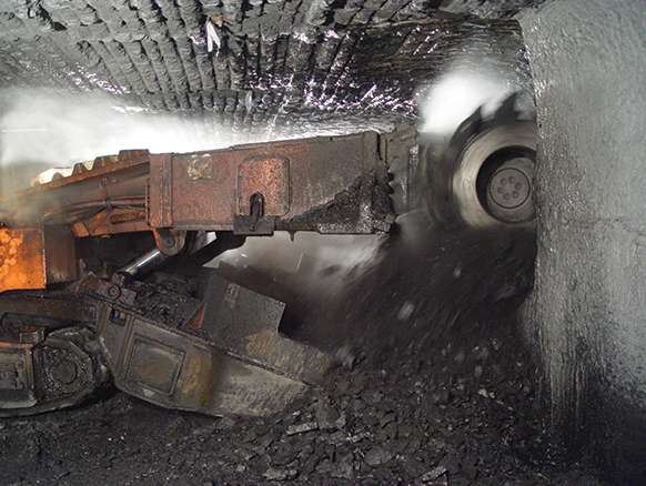
Matla comprises three underground production facilities: mine 1, mine 2 and mine 3. All three are long-life assets, each with a specific operating capacity comprising conventional coal circuits to produce bituminous coal. Work at mine 1 was stopped in 2015 due to pillar instability but an Eskom-approved project to relocate mine 1 access is currently in the implementation phase. Mine 2 and mine 3 use both bord-and-pillar and shortwall methods to mine seam 2 (S2) and seam 4 (S4) coal seams. In 2019, Matla continued with pillar extraction (stooping) as a mining method to maximise Resource extraction. At mine 2, there are four continuous miner (CM) sections (two currently stooping) and a shortwall section mining S2. At mine 3, there are two CM sections (one currently stooping) and a shortwall section mining S4 and three CM sections mining S2.
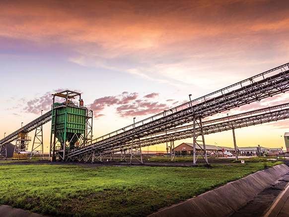
Existing infrastructure of the three shaft complexes includes three ventilation shafts, a network of conveyor belts, coal silos and stockpiles, a crushing-and-screening plant, four pollution-control dams, hospital, accommodation facilities, offices and workshops, and a water-treatment plant. Potable water is received from Eskom and no potable water plant exists on the mine property. Electricity is sourced from Eskom (Matla power station) and transporting coal from the mine to Matla power station is via a network of conveyor belts.
Matla mine produces thermal coal exclusively to Eskom. Historically, Matla produced approximately 12.5Mt of coal per annum. Due to the closure of mine 1, Matla currently produces about 6Mt of coal annually. None of the coal mined at Matla is beneficiated, but is crushed and screened (sized) before being conveyed to the power station.
The Eskom contract renewal is in 2023 but Exxaro has reasonable expectations that the contract will be renewed. The Matla Resource base is sufficient to sustain mining beyond the 2023 contract-review date where Resource thickness and quality permit mining according to existing operational standards.
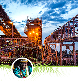
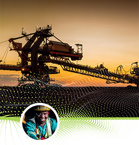
Figure 24: Matla mine
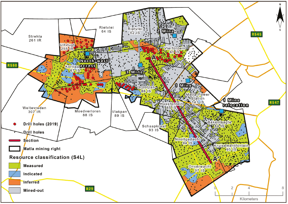
Matla has been exploiting since the mid-1970s and a significant amount of exploration and extraction activities has been conducted over the large tenure area of some 22 000ha. The 2019 geological model update includes 2 409 boreholes with coal qualities.
Table 56: Matla operation history
| Date range | Company | Material notes | ||
| 1976 - 1990 | Trans Natal Mines | Construction began in 1976,with full production in 1983 and 465 boreholes drilled in this period | ||
| 1990 - 2019 | Eyesizwe - Exxaro | Eyesizwe (now Exxaro) took over ownership from Trans Natal Mines with >2 060 boreholes drilled in this period |
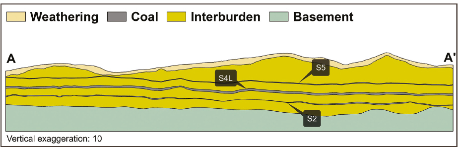
The coal deposit at Matla forms part of the Highveld coalfield. The coal seams are found in the Vryheid formation of the Karoo Supergroup. The stratigraphy sequence in the Matla area includes five coal seams that can be easily correlated with seams found in the Witbank coalfield. Coal seams in the area are generally flat and continuous, with subsequent igneous activity resulting in displacements and devolatilisation of coal seams at places.
The principal economic seams currently exploited are S2 and S4, with mining of seam 5 (S5) terminated in 1998 due to high levels of contamination and subsequent increase in abrasive index. The Matla mining area is characterised by two distinct dolerite types, the B8 (porphyritic) and B4 (olive-rich) types which have varying effects on seam displacements and coal burning and devolatilisation. A dolerite sill with an average thickness of 10m is generally found above S5 in mine 2 and 3, however, the sill intersects the coal seams and underlies S2 in mine 1 and S4 on the south-western part of the Reserves. This sill has burned and devolatilised S2 on the southern part of the mining area in mine 1. Floor rolls have been encountered in S2 workings and created some challenges in some mining sections. The floor rolls strike NE-SW vary in width between 50m and 200m and have amplitudes up to 1.5m. The floor rolls are more prominent if the seam floor is close to the basement contact. Sandstone lenses encountered are generally less than 0.5m in width but can reach up to 1.5m in thickness.
S5 was historically mined for a limited period but is currently not extracted. The seam is most prominent in the mine 2 and mine 3 areas and, to a limited extent, in the Western Limb of the southern part of the mining rights area. The roof comprises ~0.5m of thick sandy micaceous shale at mine 2 that thickens up to ~1.6m in mine 3. Above this is a competent sandstone, usually saturated with water, resulting in a weathered parting between the two sequences. This presents challenges in supporting the shale during coal extraction and must, in most cases, be removed. The seam consists of mixed coal and torbanitic material with an average thickness of 1.5m.
S2 at Matla is well developed in the north-western part of the mining area, in the mines 2 and 3 Resource areas. It thins out to the south, where thickness averages at 1.2m to 2.5m. Coal qualities are also generally poor in this area, thus S2 is not generally mined in the southern portion of the mine area. S4 is generally well distributed throughout mine 1, 2 and, to a limited extent, mine 3. Seam thickness varies between 1.0m to 5.5m and consists of homogenous, dull lustrous coal interspersed with bright coal bands.
S4 splits in two thin and poor-quality horizons impacting the economic viability in mine 3. The best S4 qualities are on the southern part of the lease area (mine 1 area). However, S4 is heavily intruded by dykes in this area, creating significant challenges for coal extraction.
Geological and structural models were updated in 2019, incorporating new information from drilling and results of reviewing previously excluded historic borehole information. The new information was used to review Coal Resource classification categories and enhanced specifically the outlines of the Indicated and Measured Resource categories.
Figure 25: Typical north-south section through Matla geological model
All data collection (geological logging, description, interpretation, sampling, validation and capturing of borehole cores information) is undertaken by on-site qualified, trained and competent geologists and aligned with Exxaro standards. A well-trained grade-control and geological mapping team undertakes mapping and reconciliation. Mapping captures intrusions, devolatilised coal, channel sandstones/in-seam partings, slumping structures, faults, joints, guttering, slabbing and floor rolls as well as measurements of mined heights, contamination and dilution. Dips and dip directions of all geological features and structures are measured and recorded. Surface mapping was only conducted where outcrops were observed.
Core loss for coal-seam intersections is recorded and a recovery of <95% through coal (by volume) is deemed unsatisfactory. Anomalies are investigated and redrilled if required. Wire-line logging is conducted on all vertical holes to enhance the definition of contacts and improve seam correlation.
All geological logging and sampling are undertaken by a team of on-site qualified, trained and competent geologists. Logging is conducted by recording of lithology down to centimetre according to the classification of the various coal "lithofacies"/coal type zones or ply (shale-coaly, coal-shaly, coal dull, coal mixed/mainly dull, coal mixed, coal mixed/mainly bright and coal bright), based on discernible lithofacies change and identified marker horizons, particularly through coal zones. All holes are captured in the acQuire Technology Solutions geological database.
All core sampling is done at the drill sites. Samples are selected according to their respective coal-seam boundaries after thorough correlation. A general rule of >0.5m seam sample thickness cut-off is applied but is evaluated in the field where necessary. In addition, the proposed mining method, mining equipment and sample mass (chemical and physical analysis required) are also considered. In-seam partings are sampled together with coal zone samples, especially the PL parting (after considering thickness) within the seam.
All geological coal core samples are sent biweekly to Siza Coal laboratory (SANAS accreditation no T0447) in Kinross. ISO and South African National Standard (SANS) have a standard set of tests and methods used for coal analyses by South African laboratories.
Resource classification was guided by SANS 10320 minimum guidelines (~350m spacing between boreholes with quality and structural information). Additional closer-spaced drilling was conducted in areas of structural complexity to ensure timely geotechnical accessibility and mineability (fall-of-ground considerations) of Coal Resources/Reserves.
Table 57: Matla Coal Resource reporting criteria
| Thickness cut-off (thickness and extraction height considerations) |
Quality cut-offs (adb) | Geological loss | ||
<1.8m |
DAFV ✥26% CV <15MJ/kg |
10% (may vary considering RODA) |
Table 58: Matla Coal Resource estimation criteria
| Item | Description | |||||
| Database | Borehole database | acQuire | ||||
| Data datum | Cape LO29 | |||||
| Number of boreholes used for Resource estimation | 2 409 of 2 474 in the database | |||||
| Validation | Conducted using queries in acQuire and Excel | |||||
| Data compositing and weighting | Conducted in Geovia MinexTM | |||||
| Model | Previous model date | 2018 | ||||
| Last model update | 2019 | |||||
| Geological modelling software | Geovia MinexTM | |||||
| Estimation technique | Growth algorithm | |||||
| Grid mesh size | 25m x 25m | |||||
| Scan distance | 2 000m | |||||
| Data boundary | 200m | |||||
| Model build limits | Upper: limit of weathering and topography/collar Lower: basement/Dwyka |
|||||
| Model outputs | Roof, floor and thickness grids generated for structure Raw quality grids |
|||||
| Changes to modelling process | None |
Table 59: Matla Coal Resource classification criteria
| Category | Type of boreholes | Borehole spacing | Structurally complex areas | BH/ha | ||||||||
| Measured | Cored boreholes with applicable coal qualities | 0m – 350m | Closer-spaced boreholes and geotechnically logged holes are required to evaluate mineability | ~0.12 (average 2 and 4 seam) |
||||||||
| Indicated | Cored boreholes with applicable coal qualities | 350m – 500m | ~0.06 (average 2 and 4 seam) |
|||||||||
| Inferred | Cored boreholes with applicable coal qualities | 500m – 1 000m | ~0.04 (average 2 and 4 seam) |
Table 60: Matla Coal Resource and Coal Reserve statement
| Category | 2019 (Mt) |
2018 (Mt) |
Difference in tonnes (Mt) |
Difference (%) |
Reason for changes | ||||
|---|---|---|---|---|---|---|---|---|---|
| Measured | 705 | 713 | (8) | (1) | Mining depletion (8.5Mt) | ||||
| Indicated | 105 | 97 | 8 | 8 | Revised Resource classification and the update of the geological model resulted in the movement between the categories | ||||
| Inferred | 232 | 240 | (8) | (3) | |||||
| Total Resources | 1 043 | 1 050 | (7) | (1) | |||||
| Proved | 145 | 172 | (27) | (15) | The decrease is primarily the result of mining as well as the disposal of mining panels related to unfavourable stooping conditions Stooping areas where the surface rights are not secured are reported as Probable Reserves |
||||
| Probable |
16 |
16 |
(0.7) |
(4) |
|||||
| Total Reserves | 161 | 188 | (27) | (14) |
Rounding of figures may cause computational discrepancies.
Scheduling of the Coal Reserve is determined using mining scheduling applications from XPAC and ProgCad. The geological 3D model used for the Coal Reserve estimation is referred to as the Reserve 3D model. The Coal Resource model uses the full coal seam while the Reserve model only defines a select mining height. The process ensures the model represents reality regarding the technical capability of current production equipment.
At Matla, Indicated Resources are generally converted to Probable Reserves and Measured Resources to the Proved Reserve category, except if any modifying factors have not been (partly) fulfilled, where the Resource is either not converted or downgraded to the Probable Reserve category, clearly stating the outstanding requirement and risk. The LoM was updated in the reporting year to incorporate new information used in the geological model update. All applicable modifying factors have been considered, specifically focusing on geotechnical as Matla faces several geological structural challenges.
A number of changes were made to the LoM plan between 2016 and 2018 to accommodate the 2015 mine 1 closure, due to pillar instability. All mining sections of mine 1 had to be placed in mine 2 and 3 to ensure that planned tonnages and qualities complied to contractual agreements. These forced changes, accelerated the need for high-resolution geological information in Reserve areas only planned for later, in the prior LoM plan. Infill vertical drilling, supplemented by horizontal drilling and geophysical surveys, has therefore increased dramatically in the last three years and the Matla team has done exceptionally well in the absence of mine 1 to keep coal production stable. However, the number of Reserve areas and associated mining flexibility will increase in the future, due to the fact that the mine 1 relocation project was approved in this reporting year. Some 27Mt of Inferred Resource in the LoM plan translate to 32% of total LoM plan. However, only 16.9% of Inferred Resources are within the five-year production plan due to focused efforts to minimise the mine 1 closure impact on Matla. Continuous exploration drilling is in place to improve the confidence level of these Resources.
Dolerite sills and dykes pose a risk for operations at Matla. Dykes have been identified through both geophysical surveys and mining observations and are known to affect S4 at mines 1 and 2 as well as S2 at mine 3. Dykes impact on production rate and roof stability, where sill activity causes burnt coal, devolatilisation and instability and mine-panel accessibility challenges. The challenges are addressed through a suite of exploration activities and are generally proactively accommodated in mine planning. Continuous surface exploration drilling aims to improve sill characterisation in mine 2, while underground horizontal drilling is used to pinpoint dykes in operating sections at mines 2 and 3. Unforeseen geological structural complexity (faulting and intrusives) poses risk for specifically the low seam Reserves at mines 2 and 3. Geological faults with a significant offset have been encountered and they have production tempo impacts mining sections.
Sizeable pillars of generally good qualities with the potential to be mined by the stooping method, are left behind due to current mining equipment limitations.
Obtaining environmental approvals for stooping, as an alternative mining method, may have an impact on the mining schedule, and require a revision of the LoM plan. The ability to extract all planned stooping Reserves is dependent on Eskom purchasing the required surface rights.
The implementation of the various expansion projects on schedule is important to ensure the availability of adequate S2 and S4 Coal Reserves.
The implementation, currently in progress, of both mine 1 relocation and the two (mines 2 and 3) expansion projects (called the north-western access projects) will unlock considerable value for the operation and provide vital mining flexibility for mine planning and operational teams.
Table 61: Matla RPEEE considerations
| Item | Criteria | Considered | Comment | ||||||
| Geological data | Data validated and signed off by competent person | Yes | Tested in 2019 | ||||||
| Geological model | Geological model considered and signed off | Yes | Seam depth, seam thickness >1.8m, dry ash-free volatiles >26% air-dried CV >15MJ/kg and ash <50% with coal qualities reported on an air-dry basis | ||||||
| Structural model | Structural model considered and signed off | Yes | Updated in 2019 | ||||||
| Mining | Mining assumptions considered and defined | Yes | Underground | ||||||
| Assurance | Minimum tier 1 assurance (Exxaro governance) | Yes | 2019 (model and chain of custody) | ||||||
| Economic evaluation | Concept-level exploitation with economic and mining assumptions, including geotechnical and geohydrological assumptions | Yes | LoM exploitation study | ||||||
| Environmental | Reasonable demonstration that environmental approvals can be obtained within the context of local, regional and national governmental legislation | Yes | All required approvals in place. Additional requirements can be demonstrated in the context of local, regional and national legislation. Land acquisitions for future stooping can be achieved based on current acquisition strategy | ||||||
| Tenure | Formal tenure must be demonstrated with reasonable demonstration that a mining right approval can be obtained within the context of local, regional and national governmental legislation | Yes | Approval for mining right is pending. Exxaro has a reasonable expectation that the right will be granted | ||||||
| Infrastructure | Assumptions used should be reasonable and within known/assumed tolerances or have examples of precedence | Yes | Current infrastructure | ||||||
| Market | A potential market for the product with a reasonable assumption that it is sustainable | Yes | Current coal-supply agreement |
Table 62: Matla production figures
| Actual 2018 |
FC 2019 |
Actual 2019 |
FC 2020 |
FC 2021 |
||||||
|---|---|---|---|---|---|---|---|---|---|---|
| RoM (Mt) | 6.7 | 6.31 | 5.99 | 7.54 | 6.25 |
Table 63: Matla modifying factors considered in converting Coal Resources to Coal Reserves
| Modifying factors | Value | ||
| Geological loss | 10% (already included in model) | ||
| Average thickness cut-off | >1.8m and <4.8m | ||
| Quality cut-offs (adb) | DAFV >26% and CV >15MJ/kg | ||
| Mining loss | Already included in model, based on specific geological conditions and mining restrictions | ||
| Depth to roof | 40m unless rock strength allows otherwise | ||
| Safety factor | Tertiary panels 1.6 and main development 2.0 | ||
| Bord width | 7.2m | ||
| Barrier pillar | At least equal to pillar width | ||
| Boundary pillar | 15m | ||
| Pillar centres | 19m x 19m or depending on depth and safety factor | ||
| Mining height | >1.8m and <4.8m | ||
| Extraction factor | Already included in model | ||
| Dilution | Already included in model | ||
| Contamination | Use select seam | ||
| Practical plant yield | N/A | ||
| Environmentally sensitive areas | Areas underlying wetlands and other eco-sensitive areas are excluded from Reserves. A higher safety factor is used underneath rivers and surface structures | ||
| Legal | Mining right boundary | ||
| Social | None | ||
| Geohydrological | None |